Project Overview
Since the appearance of smartphones with GPS doing outdoor activities has become enormously easier. There are many applications with very useful features (downloading maps for offline use, route tracking, voice warnings...), but all of these apps require prior installation on the device (possibly with associated costs) and their use is not always easy for not experienced people.
The QR geomap project aims to provide the simplest way possible so that anyone with a smartphone can do an outdoor route, lively seeing their location on a previously prepared map. Possible purposes: hiking trails, location of tourist interest points, access to canyons, caves, ...
The key feature of the project is that the georeferenced map consists of a single image (a png/jpeg file), which makes it extremely easy to share (by email, whatsapp, ...), publish on websites, blogs, social networks...
The project is presented as an "open standard" for the georeferencing of maps using simple images, encouraging the community to develop applications that facilitate their generation and use.
All contributions are welcome and highly appreciated.
How does it work?
A QR geomap file can be defined as a self-georeferenced map image. It's an image file that contains a "special QR code" printed on it's upper right corner. The image itself contains the map of an area, possibly with a highlighted line showing a route or track, waypoints or any other annotations, and the QR code contains the data (geographical coordinates) needed to georeference the map.
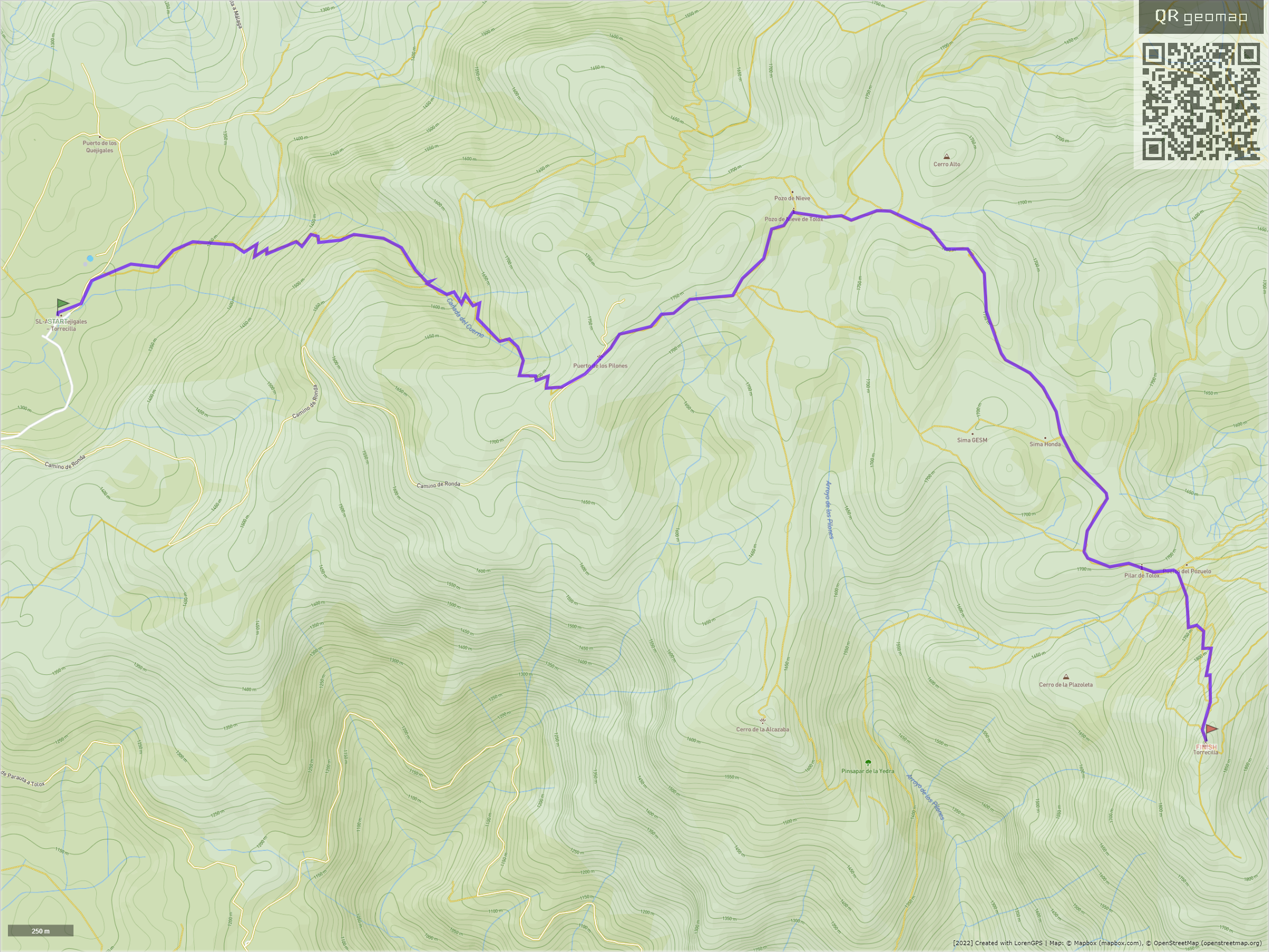
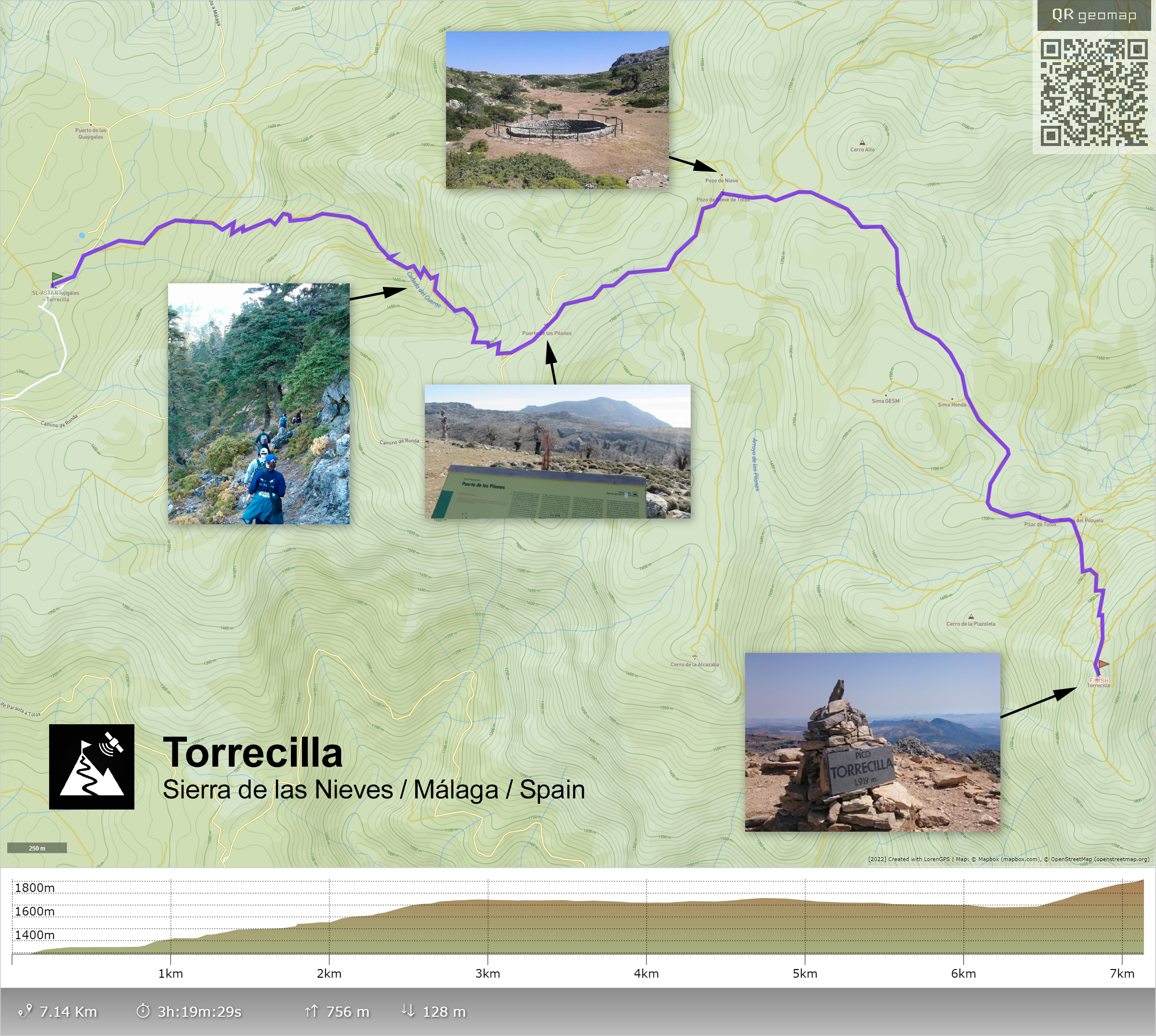
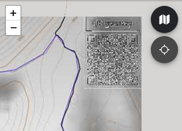
The image above contains a map with a route to the "Torrecilla" peak (in Málaga, Spain). If you scan its QR code you'll get this:
https://www.qrgeomap.com/?qrgeomap=2400_1800_36.7013932_-5.0478097_36.6687377_-4.9935214
As you can see it's an internet address (URL) that contains a parameter named qrgeomap. This parameter contains 6 numbers separated by the "_" char:
The first two numbers indicate the size of the image (2400x1800 pixels in this example). Next two numbers indicate the geolocation of the top-left pixel of the image (36.7013932,-5.0478097), and the last two numbers are the coordinates of the bottom-right pixel of the image (36.6687377,-4.9935214).
This way we have everything needed to show this image in a "map software" perfectly georeferenced.
If you want to try this out you can download the image above and then go to www.qrgeomap.com and open it.
What's www.qrgeomap.com ?
The address www.qrgeomap.com provides a basic web application that can load, decode and show a QR geomap image file, with typical pan/zoom abilities and a "geolocate" feature that allows to know and show the user's live position. That is, a basic outdoor navigation app.
It's a very simple application that basically works with two buttons:
- Map: To browse your device local storage to select and open a map image.
- Locate: To start/stop the geolocation service.
So to use a QR geomap you only have two steps: (1) Save the map image file in your device and (2) go to www.qrgeomap.com and tap the "Map" icon to load the image.
On the other hand, this app also provides a function to Create maps. With this we can load a "track" file (GPX format) and generate a map with the track drawn on it, which can be downloaded as an image for later use, or published on the web to share it with a simple link.
Another option, if a map image is hosted in a public access website, would also be directly passing its URL as a parameter. E.g: To load a map hosted in https://www.qrgeomap.com/assets/sample.png you can use this:
https://www.qrgeomap.com/?i=https://www.qrgeomap.com/assets/sample.png
Specifications
- The geographical coordinate system used is WGS84 standard.
- Generated QR codes are pasted on the top-right corner as semitransparent. This way it can be programmatically removed from the map image after been loaded.
- The qrgeomap parameter (qrgeomap=...) included in the URL is the only data needed to geolocate. The rest (first part) of the URL will be considered as the source URL. Ideally this source URL should host the map image and allow to download it; thus if someone scans a QR geomap with the camera it would provide a link to the page that provides that map.
Source URL will be shown (as link) on the app after loading the map. Use https://www.qrgeomap.com as source URL when source is not specified or unknown. - Map images can be resized and converted to different file formats (jpeg/png/...). Keeping a reasonable size and quality it will be able to be decoded, but it's recommended not to reduce the images and (if possible) use a lossless format, like PNG.
- Map images can also be modified with any photo editing app. The restrictions to keep them working are:
- Never paint on top of the QR code.
- Keep aspect (width/height proportion). You could add more data below the image (eg: a footer or legend of the map...), but only there, nothing else on top, left or right sides.
A sample image post-edited, with annotations and added footer:
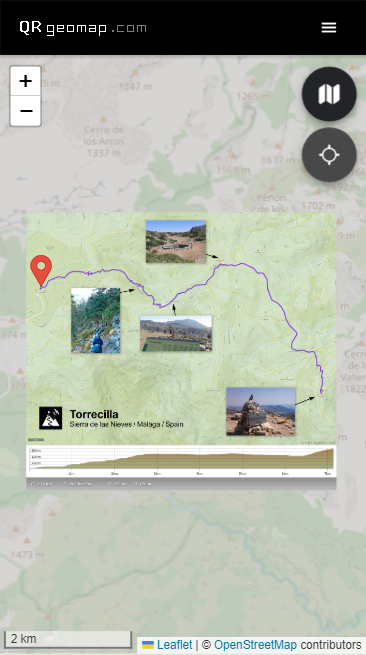
The map image loaded in the app (in a smartphone):
(note that the QR code is completely removed)
[Quality test] - Another sample image, reduced to 960 pixels width and saved as JPG with very low quality:
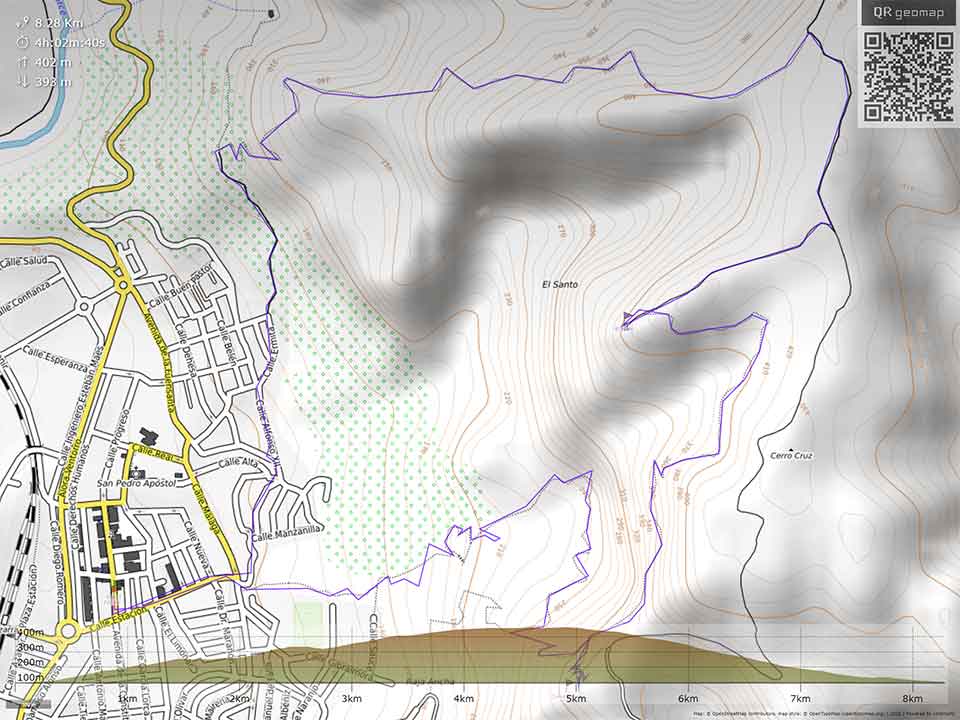
Despite the poor quality the QR code can be decoded and the image geolocated. But the removal of the QR code after loading the image is not possible (artifacts appear):
Source code
The QR geomap app (www.qrgeomap.com) is open source software. Its source code is available on Github: https://github.com/qrgeomap/qrgeomap.com
It's made with Ionic Framework (angular/typescript/javascript).